Most American travel is shaped by the infrastructure that carries it. The highway network determines which cities are reachable by car and in what time. The rail network, limited and fragmented as it is, connects certain corridors with varying degrees of reliability. The air network fills the gaps that surface transport can’t cover efficiently. Together, these systems create a geography of access that most travelers accept as fixed and navigate within without much thought about the system itself.
Culebra is an interesting exception to all of that. The island sits about 27 kilometres off the eastern coast of Puerto Rico, accessible only by ferry from the town of Fajardo or by small aircraft from San Juan. There are no large roads. No highway interchange feeds the beaches. No freight rail line runs to the port. The ferry is the main artery, and the pace of life on the island is set by its schedule. For anyone who thinks about transportation systems, whether as a professional interest or a longstanding preoccupation, Culebra offers a compressed and clarifying case study in what happens when the options are few and fixed and the island has had to organise itself around that constraint.
Here are eight reasons it belongs on the list.
1. The Ferry from Fajardo Is the Only Real Way In, and That Changes Everything
The passenger ferry from Fajardo to Dewey, Culebra’s main town, runs several times a day and takes about 90 minutes. There is a cargo ferry on a different schedule. Small charter aircraft operate from Isla Grande airport in San Juan on a demand basis. Everything else, every person, every vehicle, every piece of freight, every grocery shipment, every construction material, arrives by water.
This constraint shapes the island’s economy, its built environment, and the daily logistics of its approximately 1,800 permanent residents in ways that are visible once you start looking for them. Prices reflect transport costs in a way that mainland Puerto Rico’s prices don’t. The scale of construction is limited by what can be brought on a barge. The absence of chain retail follows logically from the difficulty of maintaining the supply chains those businesses require. Spending time on an island where ferry logistics determine what is available and at what price gives you a different appreciation for how thoroughly supply chain infrastructure shapes the places it serves, and how much of what mainland Americans take for granted about retail, food supply, and daily commerce depends on invisible freight networks of the kind covered throughout this blog.
2. Flamenco Beach Is Among the Best in the United States Territory
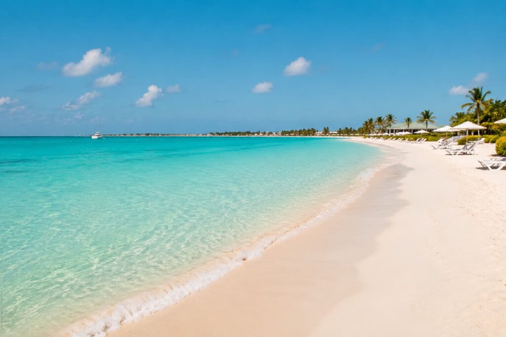
Flamenco Beach on Culebra’s northern shore consistently ranks as one of the top beaches in the United States and its territories. The ranking reflects specific physical qualities: a kilometre of white sand in a horseshoe bay enclosed by low hills, water that is shallow and clear over a sandy bottom, and a reef system at the bay’s eastern entrance that provides enough wave protection to keep the swimming conditions calm most of the year.
The road to Flamenco runs from Dewey through a gap in the hills, and at the beach itself, the only permanent infrastructure is a small concession stand and basic bathroom facilities. No hotels face the beach. No resort strip has developed along the shore. The combination of accessibility and protection from development is not accidental: most of the island’s coastline falls within the Culebra National Wildlife Refuge, managed by the US Fish and Wildlife Service, which restricts commercial development on the beaches themselves.
3. The Island Demonstrates What Car-Light Infrastructure Actually Looks Like
Culebra has roads, and most residents have vehicles, but the island’s size, around 30 square kilometres, means that car travel is almost never necessary for distances that would require driving on the mainland. Dewey, the only real town, is walkable end to end in fifteen minutes. The beaches are reachable by golf cart, bicycle, or taxi, all of which are the standard modes of local transport for visitors.
The absence of highway infrastructure changes the physical character of the place in ways that go beyond noise and traffic. Without the space requirements of high-speed road design, the scale of buildings, streets, and public spaces remains human rather than automotive. The town feels like a town rather than a service node for passing cars. For anyone who follows the American infrastructure debate, including the recurring argument about what rail investment does to the character of the communities it connects, Culebra is a live example of what a place looks like when the transport system doesn’t colonise the environment it serves.
4. The Coral Reefs Around Culebra Are Among the Best-Preserved in the Caribbean
The waters around Culebra are part of a broader marine protected area that covers most of the island’s coastline and the adjacent sea floor. The reef systems around the island, at sites including Carlos Rosario, Luis Peña, and the underwater canyons off the island’s southern shore, are in significantly better condition than most comparable sites in the main Puerto Rico island chain, where coastal development, agricultural runoff, and boat traffic have degraded large sections of reef.
The snorkelling at Carlos Rosario, accessible by a short walk over the hill from Flamenco Beach or by water taxi, puts you directly above a reef with coral coverage and fish diversity that most Caribbean destinations can no longer offer at snorkelling depth. Sea turtles are a regular presence on the reef, using the protected beaches as nesting sites in summer. The visibility on calm days is good enough to read the species names on the fish without a field guide.
5. The Logistical Challenge of Getting There Is Part of the Point
The most efficient route from the US mainland to Culebra involves a flight to San Juan Luis Muñoz Marín International Airport, a ground transfer to Fajardo on the island’s eastern tip (about an hour by car, or longer by público, the shared taxi vans that serve as Puerto Rico’s informal public transit), and then the ferry crossing to Dewey. The total journey from a US east coast city is typically five to seven hours, depending on connections and ferry timing.
That logistical effort is not a bug. It is one of the reasons Culebra has retained its character while other Caribbean islands closer to major airports have been transformed by mass tourism. The friction of the journey filters the visitor population toward people who researched the route and planned around the ferry schedule, rather than people who ended up somewhere because it was the cheapest flight. As our overview of travel planning notes, the preparation that goes into reaching a difficult destination tends to shape the quality of the experience that follows. Culebra rewards the planning that getting there requires.
6. Guided Tours Cover the Marine Environment That Shore-Based Access Misses
Culebra’s best marine sites are distributed around its coastline and offshore cays in ways that require a boat to access effectively. The snorkelling reefs, the turtle nesting beaches on the outer cays, the bioluminescent bay at Bahía Sardinas, and the dive sites off the southern shore are all reachable independently, but knowing which site has the best conditions on a given day, which tidal window opens the shallow reef passages, and which anchorages are protected from the prevailing swell requires local knowledge that most visitors don’t arrive with.
Operators like Culebra Tours run day and half-day boat excursions that cover the island’s key marine sites with guides who understand the conditions and can adapt the itinerary to what the sea is doing that morning. For visitors arriving on the ferry with a day or two on the island, this kind of guided approach covers significantly more ground than shore-based exploration alone and ensures the limited time available is spent at the right places under the right conditions.
7. The Bioluminescent Bay at Night Is One of the Few Remaining in the World
Bahía Sardinas on Culebra’s northern shore is one of a small number of bioluminescent bays remaining in usable condition anywhere in the world. The phenomenon is produced by dinoflagellates, single-celled marine organisms that emit blue-green light when disturbed, turning every movement through the water into a trail of cold fire. The density of dinoflagellates required to produce a visible effect is sensitive to light pollution, water temperature, and nutrient levels, and most of the bays that once exhibited the effect have lost it as coastal development altered the surrounding environment.
Culebra’s bay retains the effect in part because the surrounding land is protected and in part because the island’s low overall light pollution levels have not created the artificial light environment that suppresses dinoflagellate populations. Kayaking through the bay on a moonless night, watching your paddle blade trace light through the water with each stroke, is the kind of experience that has no analog in any transportation infrastructure or urban environment. It is also, in its way, a lesson in what ecosystems lose when the infrastructure of human settlement expands without accounting for the conditions those ecosystems require.
8. Puerto Rico’s Transportation History Is a Study in Infrastructure and Politics
Puerto Rico’s relationship with transportation infrastructure is one of the more instructive in American territorial history. The island once had an extensive rail network, the American Railroad of Puerto Rico, which operated between 1907 and 1953 before being shut down as highway construction and car culture displaced rail travel across the island, mirroring the same process occurring on the mainland at the same time. Today, the San Juan metropolitan area has a single urban rail line, the Tren Urbano, which opened in 2004 after decades of planning and controversy.
Culebra sits at the far end of this transportation history, beyond the highway network and beyond the rail network, connected to the mainland by the same ferry service it has relied on for over a century. For readers who follow the American passenger rail debate and the recurring arguments about what the US has sacrificed by building a transportation system almost entirely around the car and the plane, Culebra’s ferry-dependent existence is a useful counterpoint. Our coverage of the passenger transportation landscape in the US addresses some of the same underlying questions about how infrastructure choices shape the places they serve. Culebra, where those choices were made for the island rather than by it, illustrates the outcome from the receiving end.
A Final Thought
The most interesting travel destinations are often the ones that make the system visible. You don’t think much about the road network when you drive somewhere on an interstate. You think about it constantly when you’re waiting for the ferry in Fajardo at 7am, watching the cargo barge load, knowing that everything on Culebra for the next two days arrived on a vessel just like it.
That visibility is not a problem to be solved. It is one of the things the island offers. A few days in a place where the transport constraint is real and present teaches you something about infrastructure that a week of reading about American rail policy doesn’t quite reach.
Book the early ferry. Bring more cash than you think you need. The ATM on the island is sometimes out of service, which is another lesson in what happens when resupply depends on a boat schedule.